
Norway
Norway’s Atlantic Road
Experience ocean bridges, exposed coastal viewpoints, accessible island walks, fishing platforms, beaches, and the historic village of Bud.
- Location
- Hustadvika Coast, Norway
- Difficulty
- Easy
- Best season
- May to September
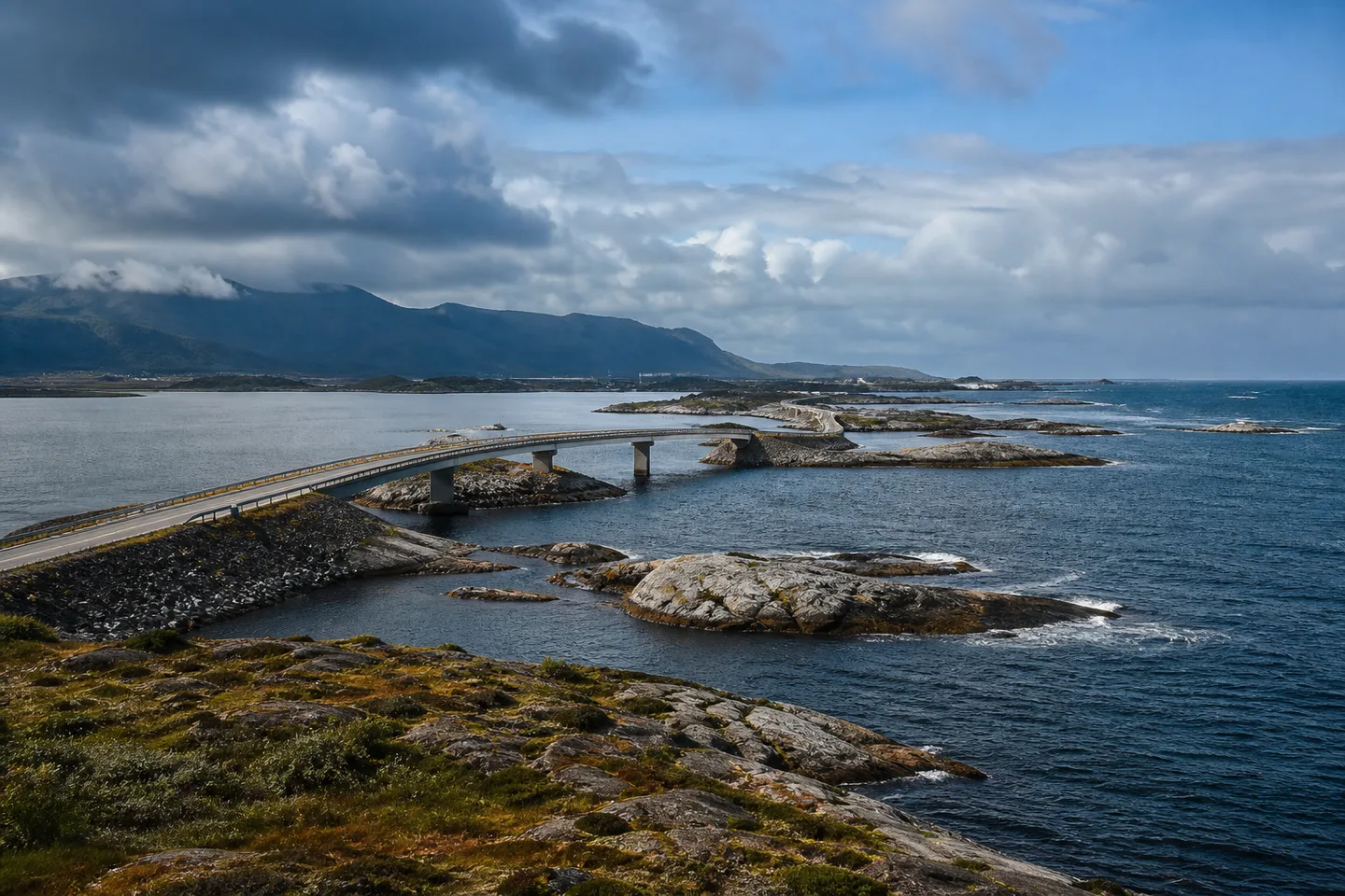
Norway's Atlantic Road is where modern engineering meets an exposed Atlantic landscape. Seven bridges curve between low islands and reefs, with Storseisund Bridge creating the best-known silhouette. The experience changes with the weather: calm evenings bring long reflections and sunsets, while wind and waves reveal the power of Hustadvika Bay.
Eldhusøya has an elevated circular walking path that opens the island landscape to a wide range of visitors. At Myrbærholm Bridge, purpose-built fishing walkways bring people close to the water, while Geitøya provides another place to pause among the skerries and coastal vegetation. Use only the marked parking and stopping areas.
Askevågen projects toward the open sea and provides a near-360-degree view across ocean, islands, and the mountainous shore. Farstadsanden adds a sandy beach and access to a coastal trail through gently rolling terrain around Vevang. These stops make the area much more than a photograph of one bridge.
At Bud, visitors can walk beside the sea toward Ergan Coastal Fort, learn about the strategic history of the coast, look back across the Hustadvika waters, and explore a traditional fishing community. Birdlife, fishing, cycling, and coastal walks are available in the wider area according to season and conditions.
Weather changes quickly on the open coast, and waves or ice can make viewpoints hazardous. Check current traffic and weather information, wear suitable clothing, and follow closures and safety barriers at every site.
Eldhusøya has an elevated circular walking path that opens the island landscape to a wide range of visitors. At Myrbærholm Bridge, purpose-built fishing walkways bring people close to the water, while Geitøya provides another place to pause among the skerries and coastal vegetation. Use only the marked parking and stopping areas.
Askevågen projects toward the open sea and provides a near-360-degree view across ocean, islands, and the mountainous shore. Farstadsanden adds a sandy beach and access to a coastal trail through gently rolling terrain around Vevang. These stops make the area much more than a photograph of one bridge.
At Bud, visitors can walk beside the sea toward Ergan Coastal Fort, learn about the strategic history of the coast, look back across the Hustadvika waters, and explore a traditional fishing community. Birdlife, fishing, cycling, and coastal walks are available in the wider area according to season and conditions.
Weather changes quickly on the open coast, and waves or ice can make viewpoints hazardous. Check current traffic and weather information, wear suitable clothing, and follow closures and safety barriers at every site.